Up in the clouds in the Carpathians
After my visit to Pervomaisk, I was keen on seeing the Ukrainain high country, and in particular climbing Mt Hoverla. The 2061 metre peak is part of the Carpathian Mountain Ranges, which span eight countries over their 1500 kilometre length. It was a 10 hour drive from Pervomaisk to Vorokhta, my destination near Mt Hoverla, so I decided to take it easy and stop half-way. Having been unable to book any accommodation for my overnight stop online, I figured I would just turn up somewhere and find a hotel.
This turned out to harder than I thought. The turning up bit was easy, and there was no shortage of hotels in the regional towns through which I passed, but none of them were open. Presumably Covid-19 was to blame, and possibly the onset of cold weather and lack of tourists. It was well after dark when I pulled into the carpark of a hotel whose name I couldn’t pronounce, in a town whose name I couldn’t pronounce either. At least its unintelligible sign was illuminated, and a small cafe at the front of the property was definitely open. I parked, and by the time I had got out of the car a lady was striding towards me. Equipped with no mutual language, we used hand signals and interpretive dance to communicate that I wanted a room for the night, and would also take up her offer of dinner in the cafe.
There was, naturally, no-one else staying at the hotel, and when the lady opened it up for me it looked like it had been closed up for some time. But she found me a room and a heater, and after I had nipped into town for some cash (Ukraine is largely a cash economy), I went over to the cafe. The lady offered me two dishes, and I recognised the name of one of them: borsch. The other was a mystery, but I ordered them both.
I incorrectly thought borsch was a stew, when it is in fact a tomato-based soup.

Mine had some veggies including something potato-like, and what looked like a small lamb bone. My borsch came with a side serve of raw sliced onion and capsicum, which I was unsure what to so with, so just munched into it. The soup was warming, if a little lacking in flavour, but along with the second course, which was a ravioli-type dumpling, did the job.
‘Another bowl?’ ‘Nah I’m right thanks’
After a good sleep I struck out the following day for Vorokhta. I picked up food for the hike in a couple of towns on the way, and after arriving spent the evening packing up my rucksack and planning my route. The only forecast I could get was for Vorokhta itself, rather than the ranges, but it looked ok and I hoped it would be similar up in the mountains.
Considering the track to the summit of Mt Hoverla is a major tourist attraction, the access road to the track head was in terrible condition. Pot holed to the point of near complete disintegration, it made for a tedious and uncomfortable ride in the hire Citroen. After a fair bit of undercarriage bump and scrape I was hoping the car rental agency wouldn’t check underneath too closely when I handed it back.
After passing the Park entry point, and paying a small fee, I continued up the rocky track. There were a couple of hikers who were walking to the track head, so I gave them a lift and we had chatted and a laughed as we laboured up the hill. The weather was foggy with a little drizzle, but I hoped it would clear as per the forecast. We parked next to a row of souvenir shops near the beginning of the walking track, and I wished the hikers well as they headed off for the climb up Mt Hoverla. After getting myself organised and having a bite to eat, I lifted my backpack and made my way to the track head at the top of the carpark.
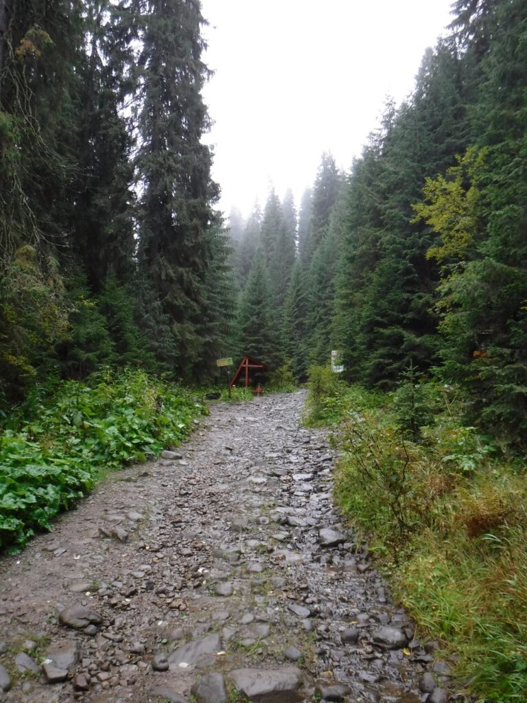
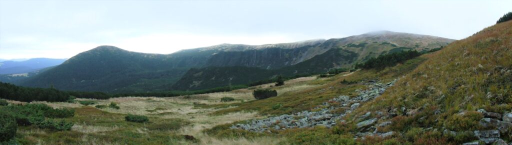
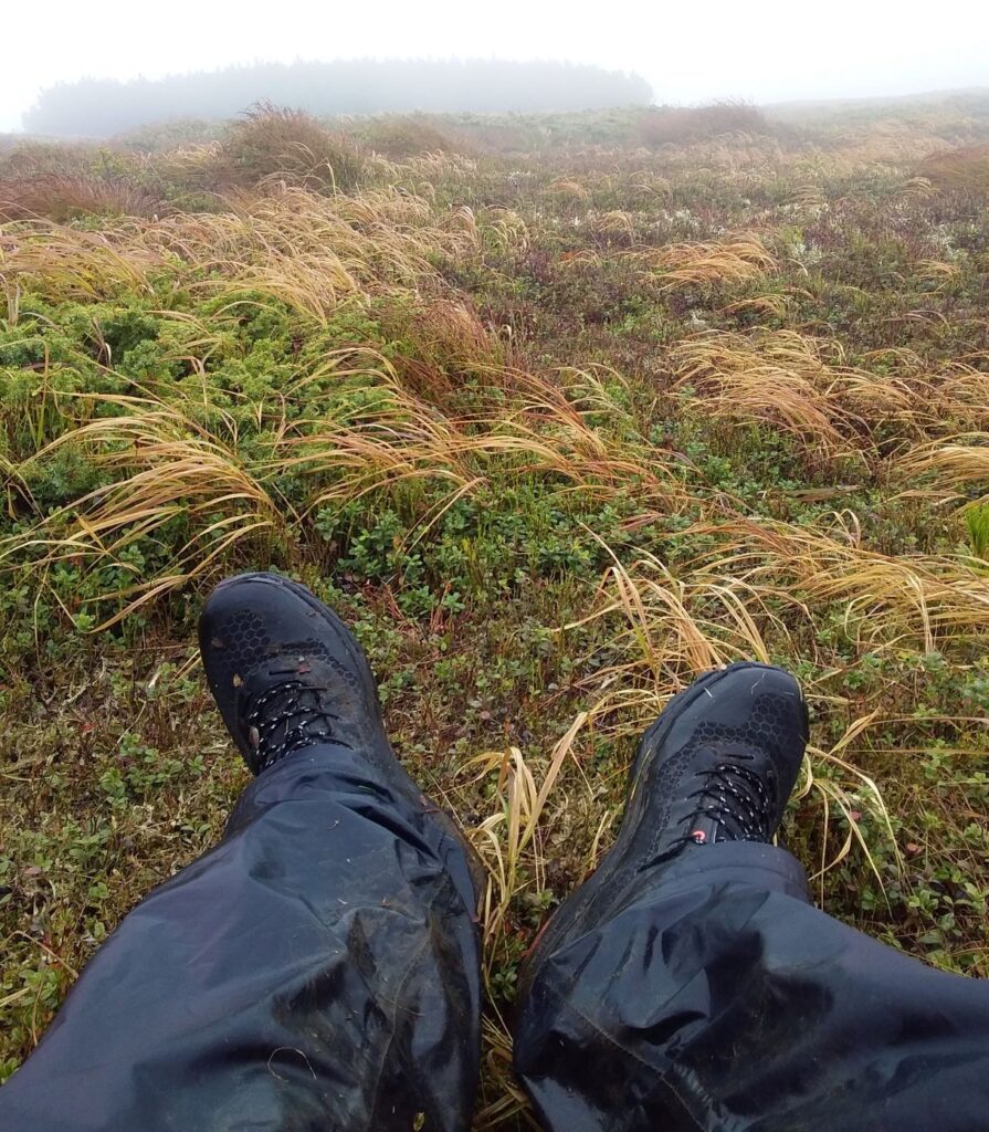
I took the south fork, and despite the drizzle the start of the walk was pretty, travelling steadily upwards through thick forest. When I stopped for lunch under the forest canopy I quickly cooled down in the chill air, so ate fast and got going again. Soon I had climbed above the treeline, and small patches of snow lay amongst the alpine heath.
‘Did you just hear banjos?’
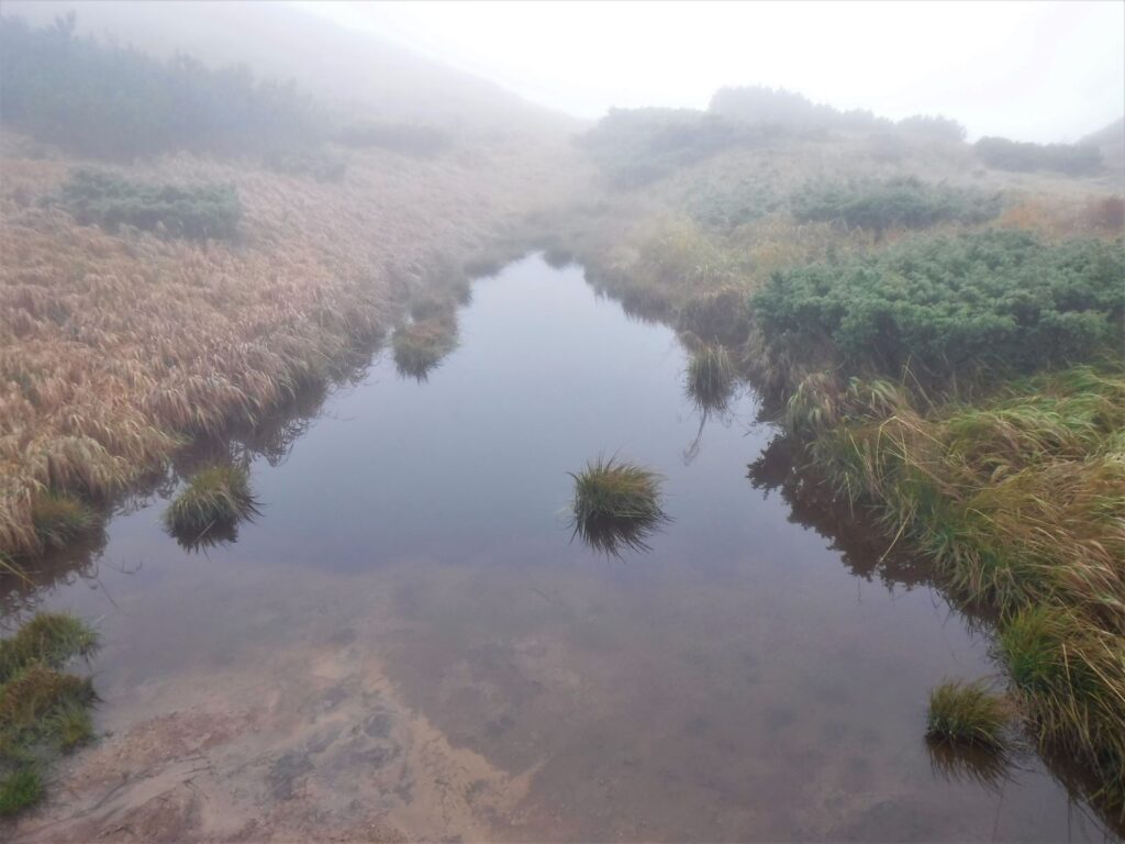
Rolling mist swept over Lake Nesamovyte, nestled at the base of the final rise to the ridgeline. I busted out the GPS and took a waypoint. I had a topographic map, but when the visibility is poor it’s nice to have a backup.
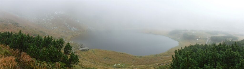
My plan was pretty loose: pick up the ridge-top walking track and head south-east along the range. Having provisions for two nights, I would find a nice camp down the spur somewhere, stay the night, backtrack the following day and head for Mt Hoverla. A second night somewhere nearer the peak and then a descent back down the next day. Climbing up to the ridgeline from Lake Nesamovyte, the weather didn’t look like improving anytime soon. When I reached the top, the howling south-westerly that I had up until then been protected from punched me clean in the face. I took another waypoint. Teetering along the top of the ridge was a battle, and I crouched a little as I went, fearing being blown to Belarus.
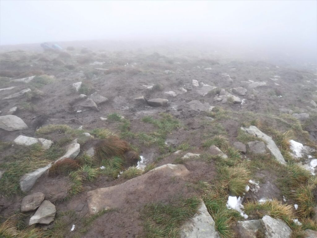
It started to drizzle, and the visibility reduced to a few metres. I slushed through the snow drifts and mud as the wind buffeted and bashed me. After cresting a small rise, I took cover behind a pile of rocks. I reassessed my position: the weather was closing in, I was having trouble seeing the track, and the windward side of my face was numb. After careful consideration, common sense prevailed. I would push on.
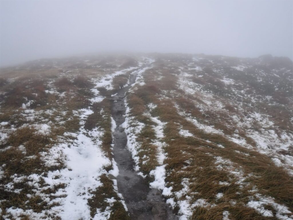
After logging another waypoint I left the shelter of the rocks and stumbled on into the white. The track was climbing again, and I was hoping I was following the walking path rather than an animal pad. I climbed up a steep section to a small peak, and was barely able to stand. The drop-off on the lee side was substantial, and I crouched for fear of being blown off. At that point, I said fuck it. I turned around, loaded up my last waypoint on the GPS, and hit ‘go’. I started walking back the way I had come, at least I thought I was, however the GPS was telling me to go in a different direction. Was there a problem with the GPS, or had I headed off track at some point, gone around a peak, and got disoriented?
It’s times like these when you have to make a decision between your gut feeling and what your electronic navigation aid is telling you. Even though it might feel entirely wrong, and your are sure you should be heading in another direction, there is a far, far greater chance that you are wrong and your nav aid is right. If everything went to shit I could just set up my bivvy bag and climb in, wait out the weather and then see where I was when it cleared up. Having this option in the backpack is always reassuring, as I new I wouldn’t come to any harm tucked up for a while. Ignoring what my head was telling me, I followed the GPS back towards where I had, apparently, come from.
It became clear after a while that I had indeed gone off-track, following around the side of a peak, which explained the unexpected reading on the GPS. After descending back down through the wind, fog, snow and mud I arrived back above Lake Nesamovyte, and happily headed down to it and out of the wind. By now it was late afternoon, and I’d had enough for the day. Below the Lake had been some stands of stunted trees, so I made for them and found a sheltered spot for my camp. Snow patches lay around my bivvy as I climbed in for the night, but I slept ok and was glad to wake up to clear skies in the morning. After breakfast, and having packed up my gear, I started out for the track to Mt Hoverla, planning to find a camp on the far side of the peak for my second night.
However, by the time I had crested the ridge once again the cloud had rolled in, the drizzle had started, and the wind had picked up. It was turning into a carbon copy of the previous day’s conditions. Before too long my face was numb again, and during a meal break hidden from the wind behind some scrub, I decided that after climbing Mt Hoverla I would head back down to the car park.
Nice spot for lunch. Sort of
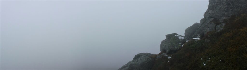
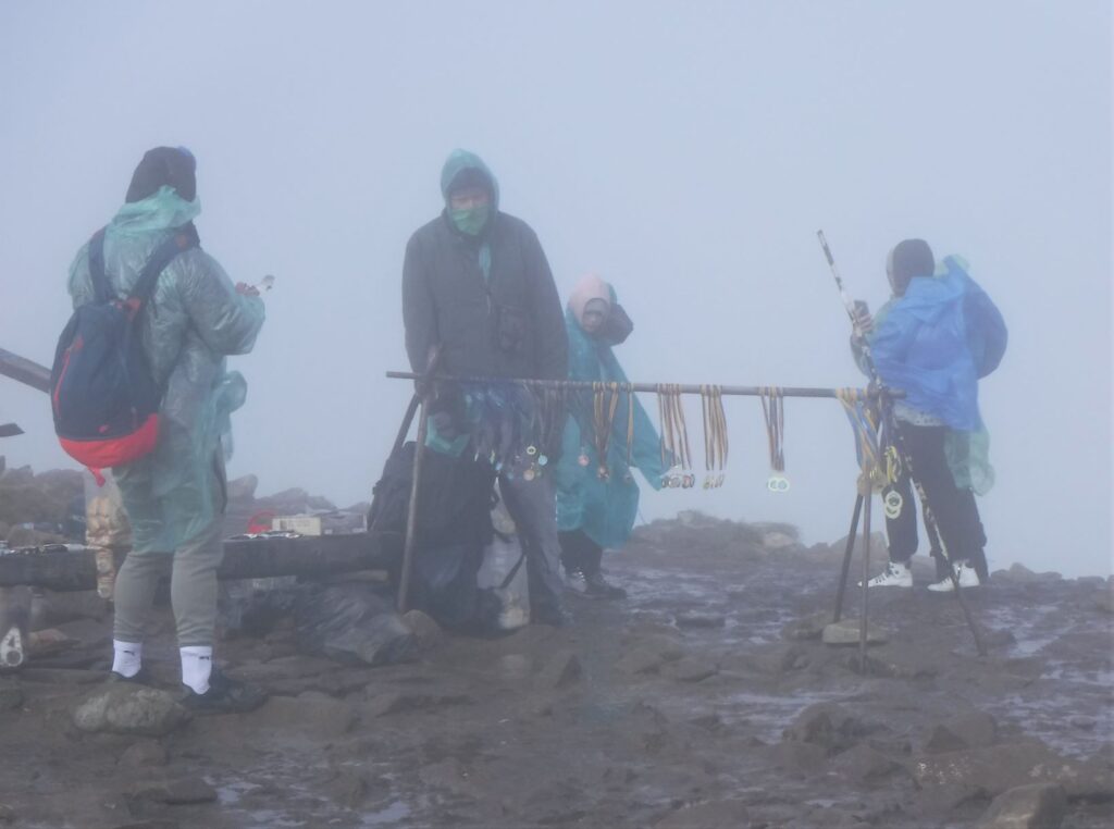
After not seeing another soul the previous day, I passed a few other hikers returning from Mt Hoverla, or battling their way to the top like me. It was a serious climb, up the scrabbly granite slopes, drifts of snow and slushy mud. By the time I reached the summit, the wind must have been blowing 35 knots plus, and visibility switching between not much and bugger all. There must have been about 30 people on the summit, struggling to take selfies in the howling wind. A wooden cross stood over the peak, and the yellow and blue of the Ukrainian flag was flying stiff atop a flagpole.
A vendor had set up a little stall selling trinkets and snacks, which I reckon was a bloody good effort considering how uncomfortable it was up there. I took some photos of the fog, and after being belted around by the wind for a while was quite happy to start the descent.
The direct route from the carpark to the peak and back gets a lot of foot traffic, and there was a steady stream of people of all ages heading both up and down.
The track had degraded to a wide muddy bog which reminded me of winter conditions on a dairy farm.
Hmmm….the hiking boots, or the gum boots?
I stepped, slipped and slithered down the mountainside, and was pleased to reach the lower sections where the track returned to a clear trail with more solid footing. By the time I reached the carpark, I thought about the bloke and his little stall up on to of the mountain. I hoped he made good money, as that was a bastard of a climb to do every day just to sell a few bits and pieces.
Well, I didn’t get to see Mt Hoverla and the greater Carpathians in all their spectacular beauty, but I certainly did have an experience of Ukraine’s alpine country. I was looking forward to a hot shower, some clean dry clothes, and a nice hot meal. But perhaps not borsch.
For more on Mt Hoverla and the Carpathians click here
If you liked this post, you may also like Seven Rila Lakes, Hiking the Archduke’s Trail
Leave a Reply